



The 2024-2025 Unmanned Aerial System surveys of the Stromboli Island ESE flank: the Digital Surface Models and the orthophotos, Istituto Nazionale di Geofisica e Vulcanologia (INGV)
DOWNLOAD DATA
The DJI Mavic 3E (RTK) dataset is summarized as follows:
- 9-10/10/2024, area: 555,000 m2, RMSE: 10.2 cm,
orthophoto 2.15 cm/px,
DSM cellsize 4.3 cm. - 7-10/5/2025, area: 1,720,000 m2, RMSE: 22.86 cm,
orthophoto 4.64 cm/px,
DSM cellsize 9.3 cm.
The DJI Mini 3 dataset is summarized as follows:
- 29/4/2024, area: 14,500 m2,
orthophoto ca. 1 cm/px. - 9-10/10/2024, area: 219,000 m2,
orthophoto 2.15 cm/px.
Luca Nannipieri, Andrea Bevilacqua, Alessandro Fornaciai, Lucas Corna, Massimiliano Favalli
Istituto Nazionale di Geofisica e Vulcanologia, Sezione di Pisa, Pisa, Italy
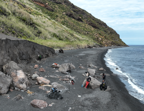
Debris flows of Forgia Vecchia were studied by a sequence of multiple Unmanned Aerial System (UAS) photogrammetric surveys in 2024 and 2025. The photographs acquired during the UAS surveys were used for generating the orthophotos and the Digital Surface Models (DSM) of the area of study through Structure from Motion and Multi-view Stereo Matching methods. We processed the photos using the Agisoft Metashape Professional version 2.2.2. software, which implements the SfM and the MSM algorithms. The vehicles and technologies employed for the flight campaigns were supplied by the Istituto Nazionale di Geofisica e Vulcanologia, Sezione di Pisa, Laboratorio di Modellistica 3D.
Two main surveys were conducted by a DJI Mavic 3E real-time kinematic (RTK) and supported by a simultaneous GNSS campaign made by R10 Trimble real-time kinematic (RTK) Differential GPS (DGPS) for acquiring check ground control points. In addition, more acquisitions were simultaneously conducted by a DJI Mini 3 on a similar area to that of the Mavic survey. In this case, when possible, the MSM processing was conducted by taking advantage of the Mavic photogrammetric alignment, and only the orthophoto is provided.
How to cite
Nannipieri, L., Bevilacqua, A., Fornaciai, A., Corna, L., Favalli, M. (2026). The 2024-2025 Unmanned Aerial System surveys of the Stromboli Island ESE flank: the Digital Surface Models and the orthophotos. Istituto Nazionale di Geofisica e Vulcanologia (INGV). https://doi.org/10.13127/stromboli/forgia-vecchia-uas-survey
Devi effettuare l'accesso per postare un commento.