



Vesuvius 1944 Eruption: DEM of Difference and Pyroclastic Density Current Deposits
Jacopo Natale1,2, Alessia Falasconi1, Teresa Oreade Grillo3, Andrea Bevilacqua4, Gianmarco Buono1, Massimiliano Favalli4, Alessandro Fornaciai4, Alessandro Frontoni5,3, Guido Giordano3,1, Emanuele Intrieri6, Rosella Nave1, Lucia Pappalardo1, Alessandro Vona3, Federico Di Traglia1,6,7
1Istituto Nazionale di Geofisica e Vulcanologia (INGV), Sezione Osservatorio Vesuviano, Via Diocleziano 328, 80124, Napoli (Italia)
2Università degli Studi di Napoli “Federico II”, Dipartimento di Scienze della Terra, dell’Ambiente e delle Risorse, Via Vicinale Cupa Cintia, 21, 80126 Napoli (Italia)
3Università degli Studi “Roma Tre”, Dipartimento di Scienze, Largo San Leonardo Murialdo 1, 00146, Roma (Italia)
4Istituto Nazionale di Geofisica e Vulcanologia (INGV), Sezione Pisa, Via Battisti 53, 56125, Pisa (Italia)
5CNR – Istituto di Geologia Ambientale e Geoingegneria (IGAG), Monterotondo, Italy
6Università degli Studi di Firenze, Dipartimento di Scienze della Terra, Via La Pira 4, 50121, Firenze (Italia)
7National Research Council (CNR), Institute of Science, Technology and Sustainability for Ceramics (ISSMC), Via Granarolo 64, 48018, Faenza, Italy
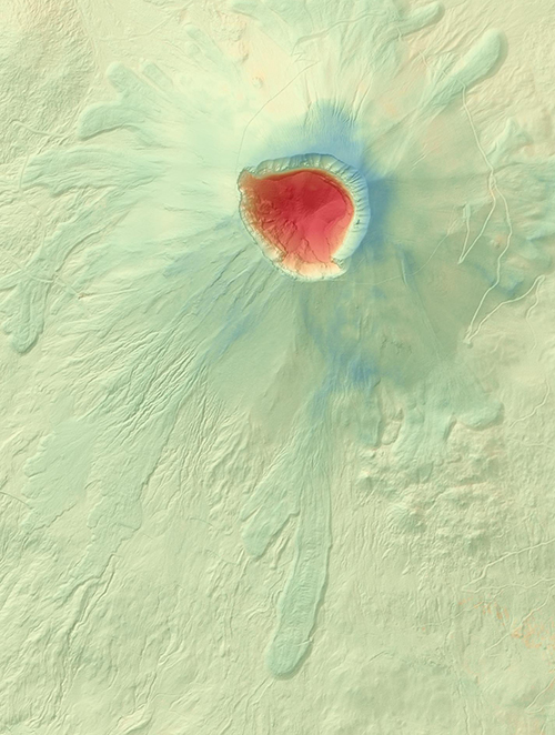
This dataset provides the DEM of Difference (DoD) computed between a historical digital surface model (hDSM) reconstructed from 1943 Istituto Geografico Militare (IGM) aerial photographs and a 2013 LiDAR-derived digital terrain model (DTM) of the Somma–Vesuvius volcanic complex (Italy). The DoD quantifies the topographic changes associated with the 1944 eruption of Vesuvius, including the construction of the new summit crater and the accumulation and remobilisation of proximal volcaniclastic deposits. The dataset also includes GIS shapefiles of the mapped detachment scars and deposit-derived pyroclastic density current (dd-PDC) deposits generated during the lava-fountaining phase of the eruption. The detachment scars were identified through geomorphological analysis of historical and modern DEMs and subsequently validated by detailed field investigations, while the deposit boundaries were reconstructed by integrating field observations with historical aerial photographs and orthomosaics (1943 and 1954). Together, these datasets provide a quantitative framework for investigating the relationship between summit morphology, gravitational instability, and dd-PDC generation, and represent a valuable resource for volcanic geomorphology, hazard assessment, and comparisons with similar gravity-driven volcanic processes at active volcanoes.
Devi effettuare l'accesso per postare un commento.