


Amiata DS
Creative commons license: Attribution 4.0 International (CC BY 4.0)
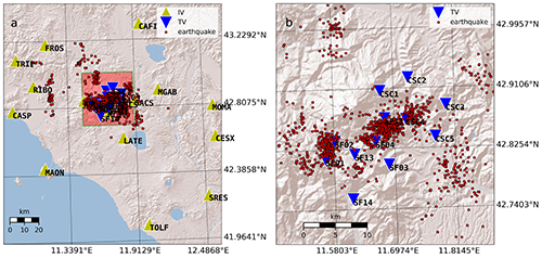
The Amiata DS (dataset) is a collection of waveforms and associated parameters (metadata) related to 1515 events that occurred in the Mount Amiata area (Tuscany, central Italy) between March 2016 and December 2020. The earthquakes have local magnitude -0.2≤ML≤3.6. Most of the data have been recorded by 12 stations (velocimeters) of a local, temporary network deployed in the area by INGV, with interstation distances ranging between 3km and 21km. Data is complemented by the registrations of other 15 stations of the Italian National Seismic Network (IV) installed farther away.
The dataset has been designed to train Machine Learning algorithms that can process waveforms and metadata. However, its reduced dimension makes it more appropriate for applications such as transfer learning, i.e., improving the performance of already trained ML models. The dataset is organized to be readily accessed by the Seisbench API (Woollam et al., 2022).
The dataset numbers:
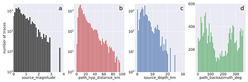
- 1515 earthquakes with -0.2≤ML≤3.6
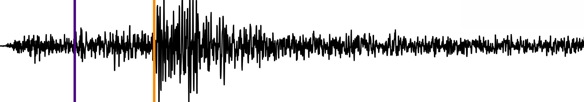
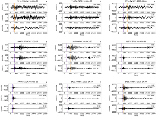
- 13721, 3-component waveforms in counts
- 72 metadata for each 3-component waveform, providing information about the station, trace, source, path and quality
- 12 stations of a local, temporary network + 15 stations of the Italian National Seismic Network
How to cite the article journal
S. Gaviano, Machine learning analysis of a local seismic network in Mt. Amiata (Italy), Nuovo Cimento 2022, doi:10.1393/ncc/i2022-22082-y
How to cite the dataset
Gaviano, S., Michelini, A., Cianetti, S., Giunchi, C., Jozinović, D., Lauciani, V., Biagini, D., Bruni, R., Capello, M., D’Ambrosio, M., Piccinini, D., & Saccorotti, G. (2023). AMIATA-DS – A dataset with microseismicity from Mount Amiata area. Istituto Nazionale di Geofisica e Vulcanologia (INGV). https://doi.org/10.13127/AI/AMIATA-DS
Download
- Events data in digital units as single hdf5 file (1 GB bz2 file)
- Events metadata as csv file (3.5 MB bz2)
This work has been supported by the project INGV Pianeta Dinamico 2021 Tema 8 SOME (grant no. CUP D53J1900017001) funded by the Italian Ministry of University and Research “Fondo finalizzato al rilancio degli investimenti delle amministrazioni centrali dello Stato e allo sviluppo del Paese, legge 145/2018”
Devi effettuare l'accesso per postare un commento.