


The 2023 Unmanned Aerial System surveys of the Stromboli Island NE flank: the Digital Surface Model and the orthophoto
Nannipieri1 L., F. Di Traglia2, M. Favalli1, A. Bevilacqua1, A. Fornaciai1*
https://www.annalsofgeophysics.eu/index.php/annals/article/view/8982
1 Istituto Nazionale di Geofisica e Vulcanologia, Sezione di Pisa, Via Cesare Battisti, 53 – 56125 Pisa, 56125 Pisa, Italy.
2 Istituto Nazionale di Geofisica e Vulcanologia, Osservatorio Vesuviano – Sezione di Napoli, Via Diocleziano, 328 – 80134 Napoli, Italy.
DESCRIPTION
Stromboli is a volcanic island located in the Tyrrhenian Sea off the northern coast of Sicily. On the night between 25 and 26 May 2023, a massive human-caused wildfire destroyed hectares of Mediterranean brush on the north side of the island, above the main village. On 12 August 2023, heavy rainfall remobilized the loose volcaniclastic material that covered the volcanic flank triggering debris flows that were channelled along the roads and flooded several buildings causing severe damage to the village.
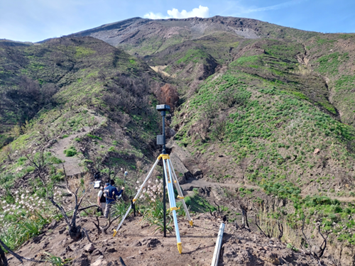
End of March 2023, an extensive UAS survey was carried out on the NE flank of Stromboli volcano over an area heavily affected by the remobilization of incoherent deposits triggered by the 12 August 2022 rainfall and the following. The survey was conducted by two UAS: a DJI Phantom pro and a DJI Phantom pro RTK. UAS surveys were supported by a simultaneous GPS campaign made by R10 Trimble real-time kinematic (RTK) Differential GPS (DGPS) for acquiring ground points to be used for georeferencing the DJI Phantom pro 3D model and for measuring the errors of the final 3D model.
28 Unmanned Aerial System surveys were carried out. The mean elevation flight was 62.7 m above ground level. 5922 photographs were acquired. The surveys covered an area of 1.4 km2. The photographs acquired during the UAS surveys were used for generating the Digital Surface Model and the orthophotos of the area through Structure from Motion (SfM) and Multi-view Stereo Matching (MSM) algorithm implemented in the Agisoft Metashape Professional version 1.6.2. software.
How to cite:
Nannipieri L., Di Traglia F., Fornaciai A., Favalli M. (2023). The 2023 Unmanned Aerial System surveys of the Stromboli Island NE flank: the Digital Surface Model and the orthophoto. Istituto Nazionale di Geofisica e Vulcanologia (INGV). https://doi.org/10.13127/stromboli/2023-uas-survey
Devi effettuare l'accesso per postare un commento.