


Stromboli DSM 2023
Authors
Marina Bisson1, Roberto Gianardi1, Riccardo Civico2, Paolo Madonia3, Tullio Ricci2, Claudia Spinetti4
DOI: 10.13127/stromboli/airborne-lidar-2023
- Istituto Nazionale di Geofisica e Vulcanologia, Pisa, Italy
- Istituto Nazionale di Geofisica e Vulcanologia, Sezione Roma 1, Roma, Italy
- Istituto Nazionale di Geofisica e Vulcanologia, Osservatorio Etneo, Catania, Italy
- Istituto Nazionale di Geofisica e Vulcanologia, Osservatorio Nazionale Terremoti, Roma, Italy
Description
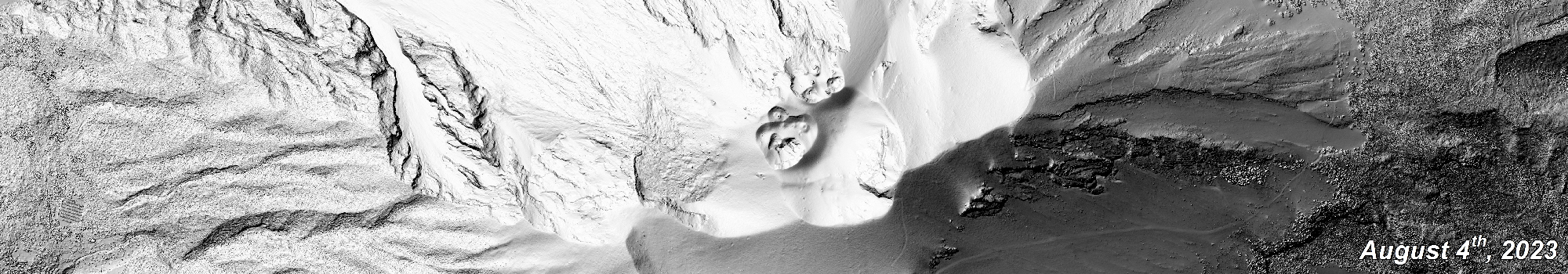
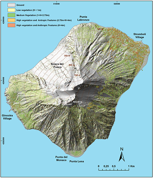
Digital Surface Models reproduce the 3D topography of a territory at different spatial resolutions depending on the acquisition technique of source data. In active and densely populated volcanic areas, updated digital topographies are fundamental for mapping and quantifying the morphological changes generated by the eruptive events and play a key role in modelling volcanic phenomena and related hazards. This work presents the high-resolution Digital Surface Model of Stromboli Island, Italy, updated to 4th August 2023. The model, obtained by elaborating more than 109×106 Airborne Lidar points (x,y,z), reconstructs the volcano’s surface through an elevation matrix at a spatial resolution of 50 cm, reproducing both natural and anthropic elements. The model has been validated by using Ground Control Points and the vertical accuracy results in 8 cm. Nowadays, this model represents the most updated and accurate digital 3D topography of the entire island and, for this reason, can be considered a relevant data not only for multi-temporal morphological and volcanological analyses but also for hazard assessment studies.
Reference
Bisson M., Gianardi R., Civico R., Madonia P., Ricci T., & Spinetti C. (2025). Lidar-derived digital surface model of Stromboli island updated to August 2023. Scientific Data, 12(1), 522.
Devi effettuare l'accesso per postare un commento.