


VULCANO DSM 2023
DOWNLOAD
Costa Vulcano DSM 2023
Vulcano DSM 2023
CSV
LICENCE
Authors
Marina Bisson1, Roberto Gianardi1,2, Francesca Iacono1, Paolo Madonia3, Gianfilippo De Astis4, Claudia Spinetti5
https://doi.org/10.13127/vulcano/vuldsm2023
1Istituto Nazionale di Geofisica e Vulcanologia, Sezione Pisa, Pisa, Italy
2Dipartimento di Scienze della Terra, Università di Pisa, Pisa, Italy
3Istituto Nazionale di Geofisica e Vulcanologia, OE, Catania, Italy
4Istituto Nazionale di Geofisica e Vulcanologia, Roma 1, Roma, Italy
5Istituto Nazionale di Geofisica e Vulcanologia, ONT, Roma, Italy
Description
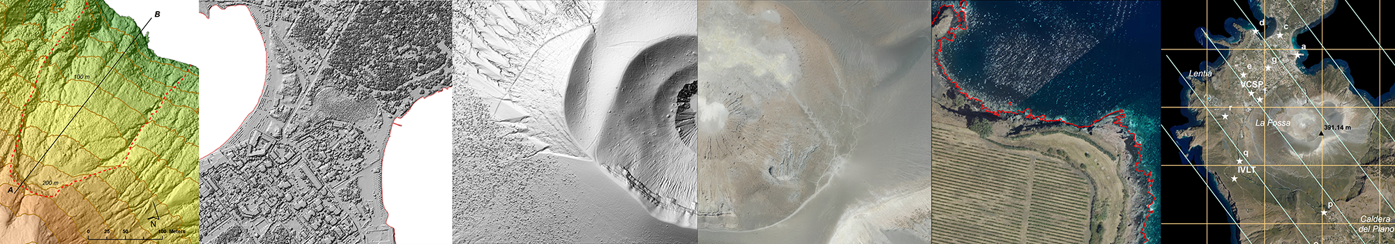
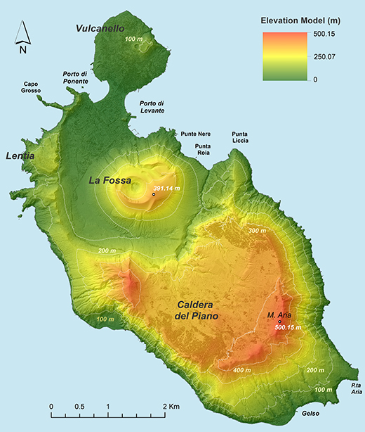
During the years 2021-2022 Vulcano island was affected by a volcanic crisis characterized by a remarkable increase in fumarolic activity, intensified seismicity and ground deformations.
With the aim of reproducing with high detail the island surface after this crisis, an Airborne Lidar survey was carried out on 4th August 2023.
More than 200 x 106 3D Lidar points were processed to create a new Digital Surface Model at a high spatial resolution of 50 cm.
This model reproduces the elevation surface of all natural and anthropic elements constituting the island.
The model was validated through a set of Ground Control Points and a vertical accuracy of 8 cm was obtained.
This accuracy, associated with the spatial resolution of 50 cm, makes the model particularly suitable for detailed and accurate geomorphological investigations.
In addition, it represents the most recent and accurate 3D topography to be used for the assessment of natural hazards, such as changes in the volcanic activity state,
earthquakes and mass movements triggered by extreme rainfalls.
References
- Bisson M., Gianardi R. (2025). Vulcano 3D points 2023 (VUL3Dp2023). Istituto Nazionale di Geofisica e Vulcanologia (INGV). https://doi.org/10.13127/vulcano/vul3dp2023
- Bisson M., Iacono F. (2025). Vulcano Coastline DSM 2023 (VULCOAST2023) [Dataset]. Istituto Nazionale di Geofisica e Vulcanologia (INGV). https://doi.org/10.13127/vulcano/vulcoast2023
- Bisson M., Gianardi R. (2025). Vulcano DSM 2023 (VULDSM2023) [Dataset]. Istituto Nazionale di Geofisica e Vulcanologia (INGV). https://doi.org/10.13127/vulcano/vuldsm2023
Devi effettuare l'accesso per postare un commento.