


Monitoring of a Coastal Zone by Independent Fast Photogrammetric Surveys: the Case of Monterosso a Mare (Ligurian Sea, Italy)
Pesci A., G. Teza, M. Bisson, F. Muccini, P. Stefanelli, M. Anzidei, R. Carluccio, I. Nicolosi, A. Galvani, V. Sepe, C. Carmisciano (2016)
Journal of Geosciences and Geomatics, 4/4, 73-81, doi: 10.12691/jgg-4-4-1
Abstract
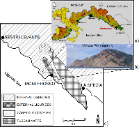
The Structure-from-Motion photogrammetry (SfM) allows a fast and easy data acquisition and a highly automated data processing, leading to accurate photorealistic point clouds. The results of a SfM-based modeling of the coastal zone of Monterosso a Mare (Eastern Liguria, Italy) are shown here. Four photogrammetric surveys of the area were carried out from both moving surface (boat) and aerial (Unmanned Aerial Vehicle) platforms. The corresponding results were compared in order to provide information about precision and model reliability from fast ad cheap SfM surveys carried out without Ground Control Points (GCPs). The important issue of scale factor evaluation was solved by means of selection of points easily recognizable in each point cloud and measurement of the length of the polyline that connects these points. The ratio between the lengths of the polyline defined on a point cloud and the corresponding polyline defined in a metric reference frame provided the scale factor. The results highlight that the SfM technique can be used in emergency conditions, where GCPs cannot be used, and is compatible with a floating platform-based observation, leading to point clouds whose resolution is some centimeters for an acquisition distance of 100-150 m.