


Gully system evolution in volcanic environments through digital elevation model comparisons: A case study from La Fossa Cone (Vulcano Island, Sicily)
Fornaciai A., M. Favalli, L. Nannipieri, R. Bonasia, A. Turchi, F. Di Traglia (2026).
Geomorphology, 502, 17 pp. https://doi.org/10.1016/j.geomorph.2026.110263
Abstract
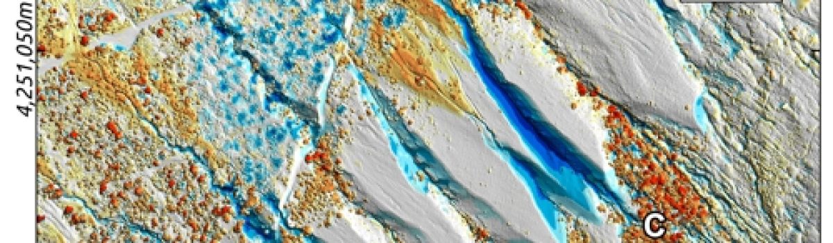
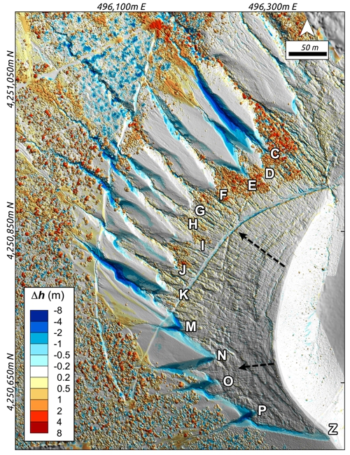
This study analyzes and quantifies the evolution of the gully system in the north-western sector of La Fossa Cone (Vulcano Island, Italy) between 2010 and 2022. This area generates small-volume debris flows with the potential to cause damage to the village at the foot of the cone. The morphological changes described here were assessed by comparing Light Detection and Ranging (LiDAR)-derived and Unmanned Aerial System (UAS)-derived digital topographic data collected during successive aerial surveys. We found that the NW gully system of La Fossa Cone is a dynamic environment where erosion acts differently across the system and is strongly influenced by human activity, as in the case of the construction and modification of the path to the summit. We calculate that, over 12 years, a total of 17,820 m3 of tephra deposited during the 15th–20th century eruptions was eroded from the gullies and transported onto the cone flank and beyond. More than 50% of this volume loss occurred in just three gullies: two in the northern zone and one in the southern zone. The mean erosion rate of 1485 m3/year was comparable to the mean erosion rate of 1887 m3/year inferred here for the period between the 1888–90 tephra deposition and 2022. In addition, we performed a morphometric analysis of the gully system and, based on the results obtained, we describe a conceptual geomorphic model characterized by three phases leading to the progressive removal of the uppermost unconsolidated deposits, in which the steepest descent angle within the gully plays a major role in controlling erosion.
Devi effettuare l'accesso per postare un commento.