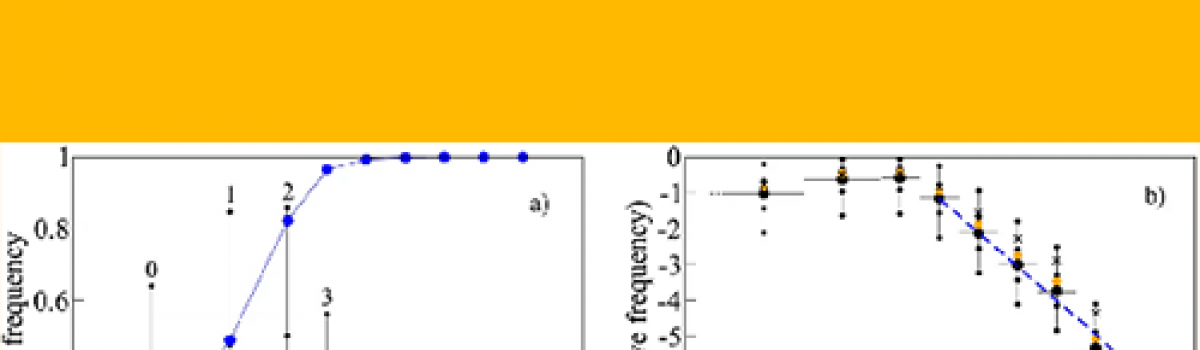
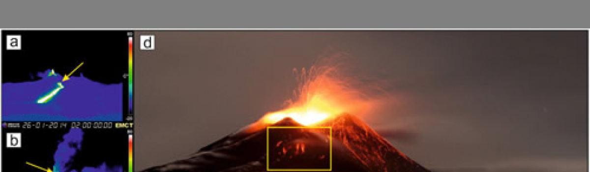
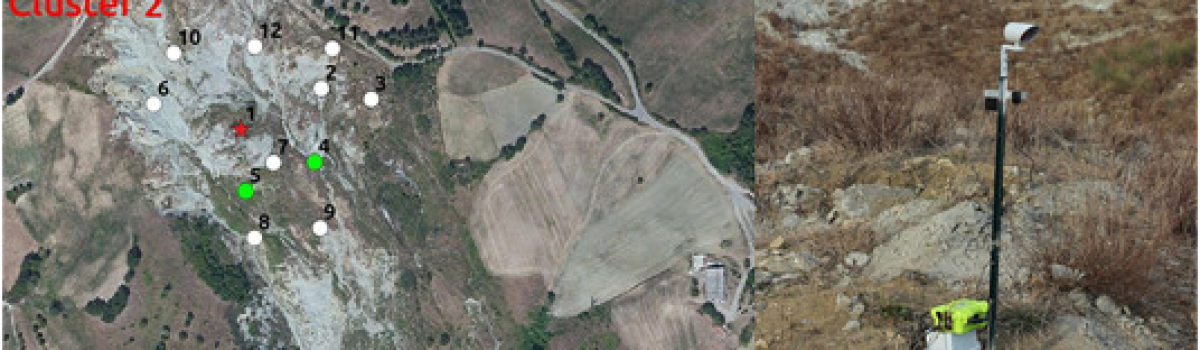
Figure 1Open in figure viewerPowerPointInput data: (a) shaded relief of the TINITALY DEM (Tarquini et al., 2012b) with the final July-August 2001 lava flows (modified after Behncke & Neri, 2003); (b) shaded relief of the 2004 LIDAR DEM (Mazzarini et al., 2005) over the DEM difference map…
News
Surface ruptures following the 30 October 2016 Mw 6.5 Norcia earthquake, central Italy
Civico R., S. Pucci, F. Villani, L. Pizzimenti, P. M. De Martini, R. Nappi & the Open EMERGEO Working Group (2018).
Journal of Maps, 14/2, 151-160, doi: 10.1080/17445647.2018.1441756
Identification of leveled archeological mounds (Höyük) in the alluvial plain of the Ceyhan River (Southern Turkey) by satellite remote-sensing analyses
Bini M., I. Isola, G. Zanchetta, A. Ribolini, A. Ciampalini, I. Baneschi, D. Mele, A.L. D’Agata (2018).
Remote sensing, 10/2, 241, ISSN: 2072-4292, doi: 10.3390/rs10020241
UAV-based remote sensing surveys of lava flow fields: a case study from Etna’s 1974 channel-fed lava flows
Favalli M., A. Fornaciai, L. Nannipieri, A. Harris, S. Calvari, C. Lormand (2018).
Bulletin of Volvanology, 80/3, https://doi.org/10.1007/s00445-018-1192-6.
A 10,000 yr record of high-resolution Paleosecular Variation from a flowstone of Rio Martino Cave, Northwestern Alps, Italy
Zanella E., E. Tema, L. Lanci, E. Regattieri, I. Isola, J.C. Hellstrom, E. Costa, G. Zanchetta, R.N. Drysdale, F. Magrì (2018).
Earth and Planetary Science Letters, 485, 32-42, doi: 10.1016/j.epsl.2017.12.047
Wavelet analysis of d18O and d13C time-series from an Holocene speleothem record from Corchia Cave (central Italy): insights for the recurrence of dry-wet periods in the Central Mediterraneans
Tognarelli A., G. Zanchetta, E. Regattieri, I. Isola, R.N. Drysdale, M. Bini, J.C. Hellstrom (2018).
Italian Journal of Geosciences, 137/1, 128-137, ISSN: 2038-1719, doi: 10.3301/IJG.2017.21.
Devi effettuare l'accesso per postare un commento.