


Wildfires Induced by Volcanic Activity at Stromboli Islandduring the 2019 Summer through Satellite and Drone Data
acquired a few days after the 3rd of July 2019 paroxysm
Iacono F., · M. Bisson, · C. Spinetti, · T. Kwasnitschka, (2025).
Remote Sensing in Earth Systems Sciences. https://doi.org/10.1007/s41976-025-00215-6
Abstract
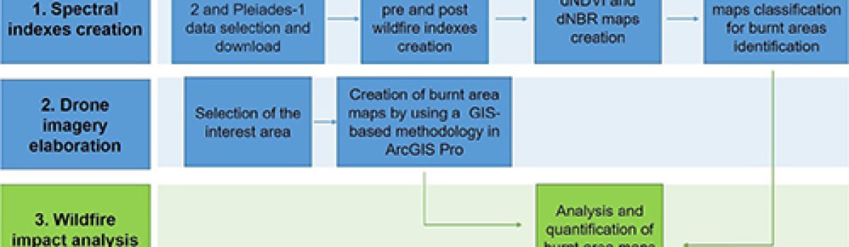
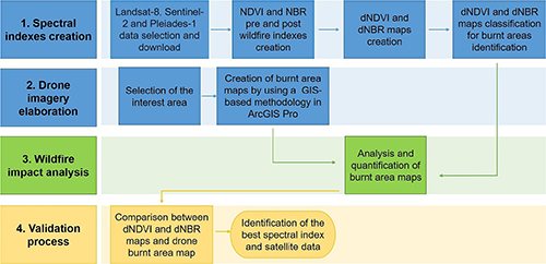
Active volcanic areas with intense explosive activity are often affected by secondary hazardous phenomena, such as wildfirestriggered by incandescent ballistic material that hits vegetated zones. A testimony of this was the wildfire induced by the3rd of July 2019 paroxysm at Stromboli Island (Aeolian Archipelago, Italy). This wildfire involved significant portions ofterritory and caused the loss of a human life. In order to produce an accurate mapping and quantification of the burnt areasduring the 2019 summer, the spectral indexes NDVI and NBR were derived from Landsat-8, Sentinel-2 and Pléiades data.The maps of difference in NDVI and NBR, between pre- and post- paroxysm of 3 July, were compared with the burnt areasmap obtained by a very high spatial resolution drone imagery. Sentinel-2 dNDVI map results the most accurate and identi-fies 3.60 km 2 of burnt areas covering 29.5% of the entire island. New investigations on 4 July–5 September period allowed,for the first time, to distinguish 12 outbreaks and map the burnt areas related to the intra-paroxysms volcanic activity (from4 July to 27 August) and those generated by the second paroxysm (28 August), resulting in 1.76 km 2 and 0.11 km 2 , respec-tively. Overall, during the 2019 summer, the wildfires induced by volcanic activity burned a total area of 5.47 km 2 (43.5%of the island), affecting mainly the southwest and southeast flanks. Finally, evidences on the wildfire vegetation resiliencehas arisen, and hazard evaluations indicated that all touristic pathways were involved by the wildfires except the northernone positioned at elevations < 300 m a.s.l.
Devi effettuare l'accesso per postare un commento.