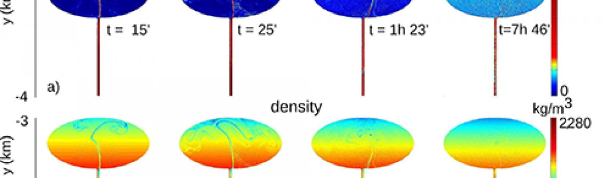
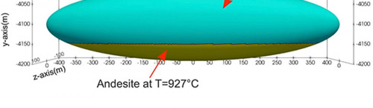
FIGURE 9. Timescales representative of magmatic processes calculated from Fe–Mg diffusion modeling compared to Fo (mol%) concentration profiles in olivine crystals from samples ST07-19 (July 2019) and ST207 (1456). Modeling was performed using the DIPRA software (Girona and Costa, 2013). Natural data (black) with error bars and calculated diffusion…
News
The use of historical cartography and ALS technology to map the geomorphological changes of volcanic areas: A case study from Gran Cono of Somma-Vesuvius volcano
Fig. 9. 3D perspective views of the morphological changes for different time frames: a) 1876–1906; b) 1906–1929; c) 1929–1944; d) the whole investigated period (1876–1944). Bisson M., A. Tadini, R. Gianardi, A. Angioletti (2021).Geomorphology, volume 380, https://doi.org/10.1016/j.geomorph.2021.107624. Abstract The eruptive activity of a volcano modifies…
Einstein Telescope: al via la campagna di misure geofisiche
In Sardegna procedono le misurazioni scientifiche per la caratterizzazione del sito delle miniere di Sos Enattos, a Lula, per la realizzazione dell’osservatorio di onde gravitazionali di terza generazione Einstein Telescope. Oggi, 20 gennaio 2020, in Sardegna, avrà inizio l’installazione della prima rete di sensori sismici su larga scala per una…
Reproducing pyroclastic density current deposits of the 79 CE eruption of the Somma–Vesuvius volcano using the box-model approach
Figure 2(a) Location of the Somma–Vesuvius volcano. Coordinates are expressed in the UTM WGS84-33N system. (b) The EU3pf unit (Cioni et al., 2020); (c) the EU4 unit (Cioni et al., 2020). In (b), solid lines are the limits between EUs, dashed lines are the limits between levels…
PyTirCam-1.0: A Python Model to Manage Thermal Infrared Camera Data
Figure 4. Exported Mt. Etna image in .jpg format by means of ResearchIR software in the temperature range of [−10, 60] °C. The frame captures an instant of the 16 November 2006 paroxysmal episode at the South East Crater (SEC), showing: (i) The explosive activity above the…
Dalla Miniera alle Onde Gravitazionali: Sos Enattos in Sardegna individuato come sito ideale per l’osservatorio ET
Fig. 1 – Rendering dell’EinsteinTelescope. L’infrastruttura sotterranea, con gallerie di 10km di lunghezza,ospiterà 6 interferometri dedicati all’osservazione delle onde gravitazionali Fig. 1 – Artisticrendering of the Einstein Telescope. The underground infrastructure, with10km-long tunnels, will host 6 interferometers for the observation ofGravitational Waves Fig. 2 – Distribuzione in probabilità della potenza…
Devi effettuare l'accesso per postare un commento.