


UAS-based mapping of the July 3, 2019, ballistics density distribution on the W flank of Stromboli with uncertainty quantification
Bevilacqua A., L. Nannipieri, M. Favalli, A. Fornaciai (2024).
Bulletin of Volcanology, 86, 48. https://doi.org/10.1007/s00445-024-01741-9
Abstract
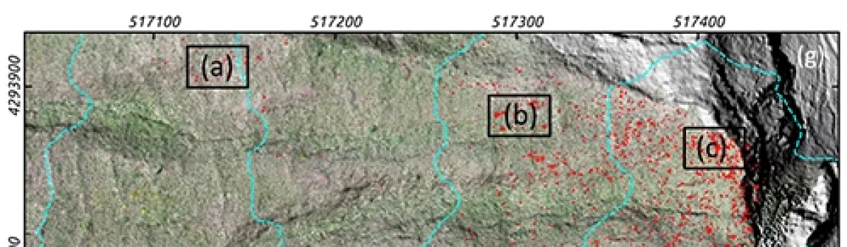
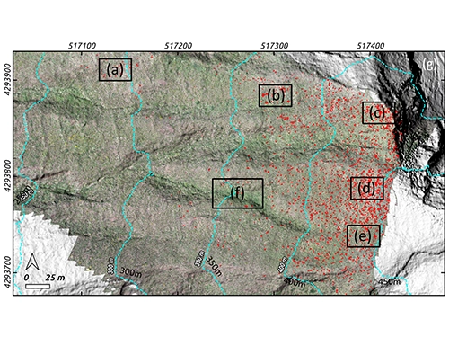
Stromboli is a volcanic island in a persistent state of activity, located off the northern coast of Sicily. The paroxysms have been the most powerful explosive phenomena at Stromboli in the last 150 years. These explosions can produce ballistic projectiles that can heavily affect trails and observation sites as well as hit inhabited areas at lower elevations, down to the coast. On July 3, 2019, a paroxysm significantly affected a great portion of the island with ballistic projectiles. In particular, many decimeter and meter-sized spatter bombs hit the W flank of Stromboli, and ignited multiple fires. In May 2022, we conducted an Unmanned Aerial System photogrammetric campaign over a sector of the W flank of Stromboli that was heav-ily affected by the paroxysm. The largest clasts were still preserved after 3 years, not disturbed by significant mass wasting phenomena or human interference, and they were not yet hidden by the post-fire regrowth of the brush vegetation. In this study, we constrained the main sources of uncertainty affecting the bombs distribution on the ground, by characterizing a percentage of uncertain clasts, testing various density estimators, and by modeling an areal buffer around the mapped clasts. We produced a 0.18 km 2 wide 1.6-cm resolution orthomosaic, a 10-cm resolution Digital Surface Model, and 2813 outlines of the mapped ballistics. Spatial distribution of the ground cover and associated uncertainty were analyzed as a function of the distance and of the angular direction from the source.
Devi effettuare l'accesso per postare un commento.