


Vents opening susceptibility map of the Colli Albani long dormant volcano
Bisson M., R. Isaia, R. Nave, A. Pensa & G. Giordano
Geomatics, Natural Hazards and Risk, 14/1. https://doi.org/10.1080/19475705.2023.2215905
Abstract
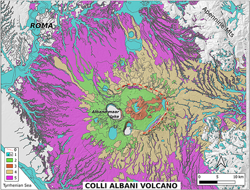
Despite their protracted periods of inactivity, long-dormant volcanoes may be highly hazardous, as their reactivation can be characterized by violent explosive eruptions. An example of such volcanoes is the Colli Albani caldera, onto which deposits Rome Capital City is built, Italy. Its last volcanic activity was characterized by voluminous maar-forming phreatomagmatic eruptions dated between 36 and 25ka, but the volcano has produced several maar lake overflows during the Holocene till historical times. Presently, Colli Albani is affected by recurrent seismic events, anomalous heat flow, ground uplifts, hydrothermal circulation and gas emissions. For these reasons, the Italian Civil Protection has recently listed Colli Albani among the ten active volcanoes of Italy, but products for the evaluation of its volcanic hazards lacking. This work presents the first study on vent opening susceptibility mapping at Colli Albani. We explore the potential of an available geological dataset for building, through geographic information system analysis, an index that classifies areas at different vents opening susceptibility (low, moderate and high). Such result highlights as a solid geological mapping is a prerequisite for the volcanic hazard assessment, especially in remote or poorly studied long-dormant volcanoes such as caldera systems where the location of new vents could occur in different volcano sectors.
Devi effettuare l'accesso per postare un commento.