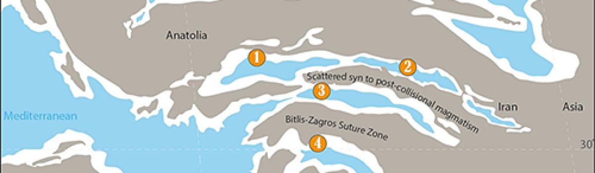
Fig. 9. a) Simplifield paleogeographic reconstruction of the eastern Mediterranean region during the middle Burdigalian, modified from Palcu et al. (2023). The figure illustrates the terminal stage of Neo-Tethys marine connectivity and the early collision between Arabia and Anatolia. Magmatism north of the Zagros suture is represented as localized…
Archiviati
Bright night 2026, al via i lavori per l’evento del 25 settembre
300 mila euro per BRIGHT-NIGHT dalla Commissione Europea Il progetto coordinato dall’Università di Pisa e di cui INGV è ente associato, è stato finanziato per il biennio 2026-2027. A settembre torna nelle piazze la Notte europea delle ricercatrici e dei ricercatori L’Università di Pisa ha ottenuto un finanziamento di 300…
Central Mediterranean tephrochronology and explosive volcanism over the240–190 ka interval: Insights from the high-resolution record of CastiglioneMaar, central Italy
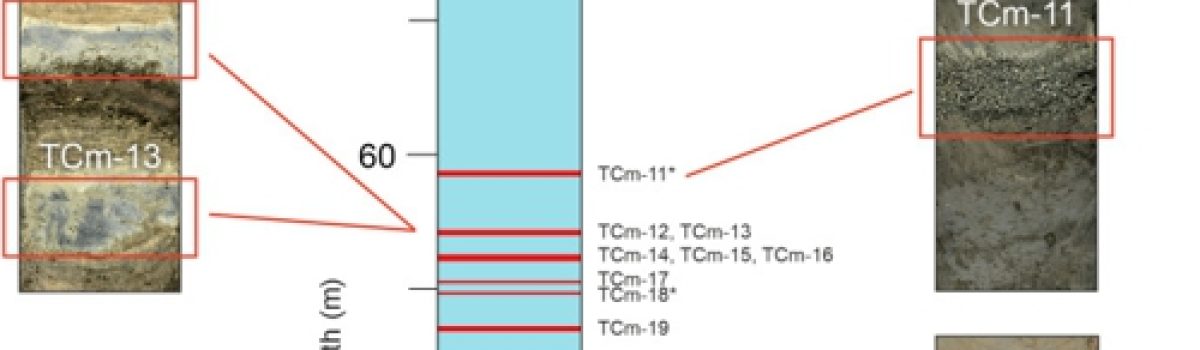
Figure 3 Composite sequence tephrostratigraphy for the studied Marine Isotope Stage (MIS) 7 interval. The figure illustrates the stratigraphic positions of the studied tephra layers plotted against composite depth (m). High-resolution photographs display representative tephra layers from core C1-C2 (highlighted by red rectangles), illustrating their primary stratigraphic features and visual…
Cognitive biases and rational decision making for volcanichazards and risks
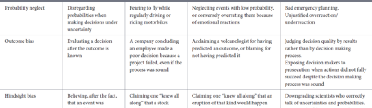
Table 1 Cognitive biases described in this contribution. Papale P. (2026).Frontiers in Earth Science, 14 pp. https://doi.org/10.3389/feart.2026.1755833 Open access Abstract Volcanic systems are governed by complex, non-linear dynamics that make deterministic forecasting impossible and require decisions to be made under substantial uncertainty. This…
Gully system evolution in volcanic environments through digital elevation model comparisons: A case study from La Fossa Cone (Vulcano Island, Sicily)
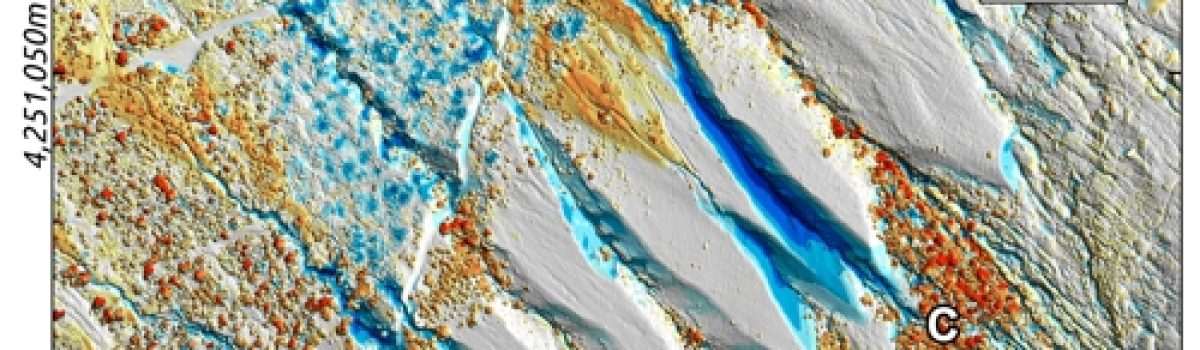
Figure 3 Difference of DEM map over the entire monitoring period, showing the main topographic changes on the NW gully system from 2010 to 2022. The difference map of the DEMs is overlaid on the 2022 DSM hillshading. Consequently, the areas that appear gray on the map correspond to the…
Quantifying Gas and Thermal Energy Emissions in an Active Geothermal Area: Insights From Le Biancane (Larderello Field, Italy)
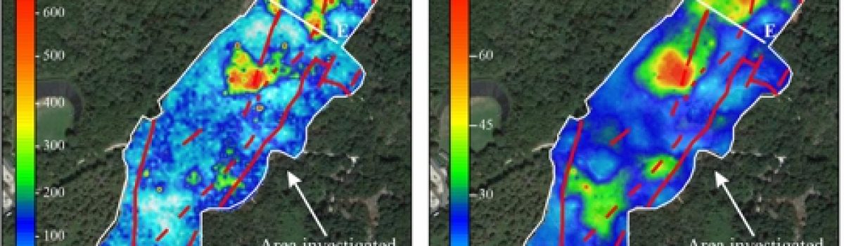
Resulting maps of a) Soil CO 2 flux; b) Soil temperature; and c) Thermal gradient in the Le Biancane area; d) Schematic representation of the various terms of the thermal balance at the surface soil of a heated from below area. The thicker solid arrows represent the terms that supply…
Devi effettuare l'accesso per postare un commento.